Borssele wind farm cable
DOWNLOAD PROJECT SHEET
Metocean study, current modelling (FINEL), wave modelling (SWAN).

TenneT TSO

the Netherlands

2015 - 2016
Metocean study
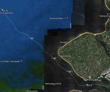
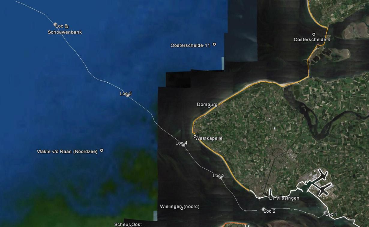
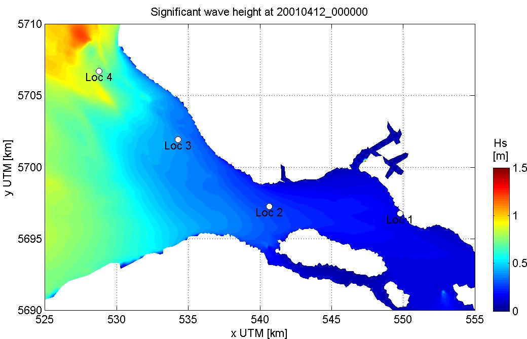
To connect Borssele Wind Farm to the shore power grid four AC export cables will be laid through the Western Scheldt estuary and landfall just east of Borssele. Svašek Hydraulics has conducted a metocean study for several points along the cable to determine downtime during cable installation.
Along the cable route wind, wave, current and water level conditions were determined for a period of 10 years. The wind time series have been generated by means of interpolation of measured wind data in locations Vlissingen, Vlakte van de Raan, Hoofdplaat and Oosterschelde 4.
The water levels and current velocities for the output locations have been determined with the model FINEL. The model covers the entire continental shelf and is forced with tidal components and historical fields of pressure fluctuations and wind shear. The model is validated with local water level measurements at Vlakte van de Raan, Westkapelle and Vlissingen and flow velocity measurements at Bol van Heist and de Wandelaar. The highest water level in the time series correspond very well with the 1/10 year water level as determined by Rijkswaterstaat.
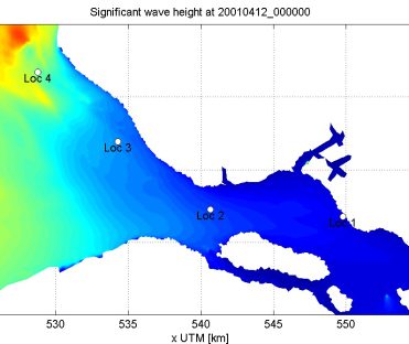
Wave conditions in the output locations are computed with a local SWAN model that is forced with wave conditions at Europlatform (northern boundary) and Westhinder (southern boundary) and spatially varying wind fields based on local measurement stations. The wave model has been validated at measurement station Vlakte van de Raan and Wielingen.
Anna Kroon
Project leader
MORE INFORMATION ABOUT SVAŠEK OR OUR EXPERTISES?
Please contact us or make an appointment.
CONTACT US