
Bjørnafjorden floating bridge
DOWNLOAD PROJECT SHEET
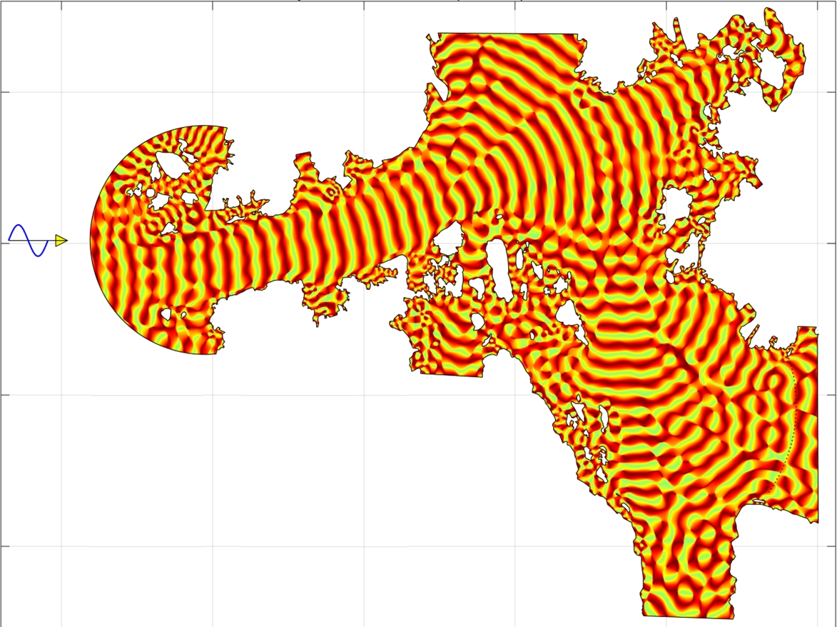
Wave penetration study to determine wave conditions and phase differences between consecutive bridge pontoons

Statens vegvesen (Norwegian Public Roads Administration)

Bjørnafjorden, Norway

2022
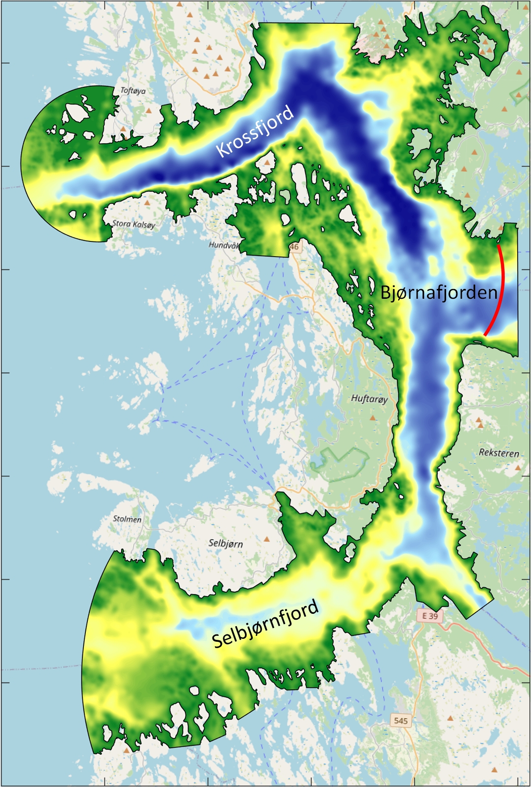
Wave penetration study Norwegian fjord
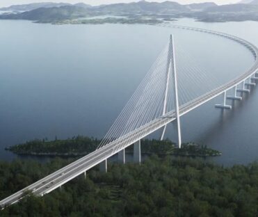
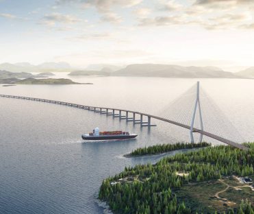
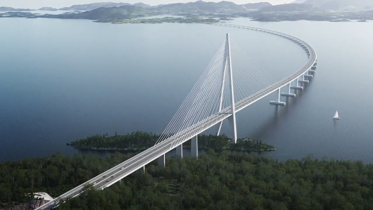
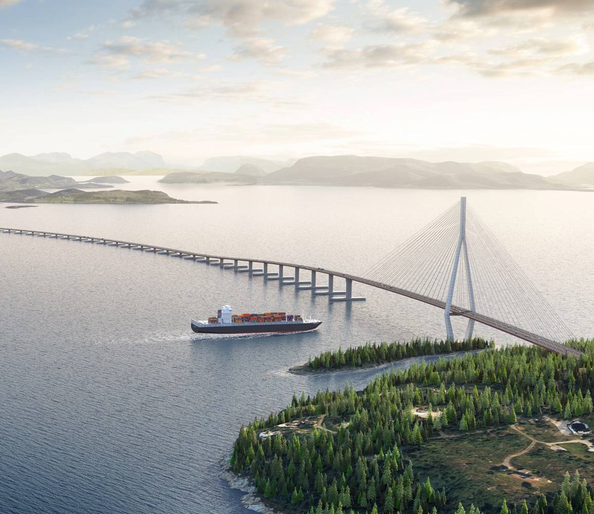
The Norwegian Public Roads Administration (NPRA) plans a floating bridge crossing in Bjørnafjorden to replace the existing ferries. At the planned crossing, the water depth is approximately 550 m, and the width of the fjord is approximately 5 km. These conditions make it impossible to use conventional bridges. Currently, the chosen solution is an anchored curved floating bridge with a cable stayed bridge connected to land on the southern shore. The floating bridge will have 40 pontoons.
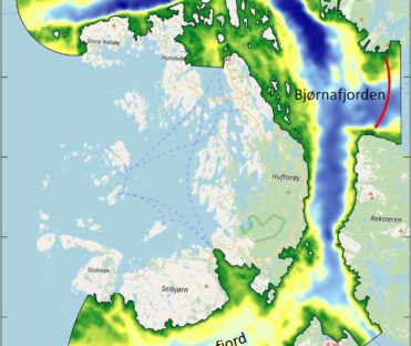
Long-term wave measurements at Bjørnafjorden show that wind waves and swell waves occur at the project site. The observed swell waves are generated in the North Sea and North Atlantic Ocean and then propagate into the fjord through the Krossfjord (north) and Selbjørnfjord (south). Swell waves are very relevant as they can interact with the bridge and may excite undesirable behaviour on the construction.
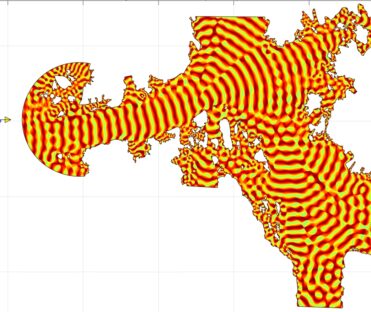
NPRA requested Svašek Hydraulics to investigate the behaviour and propagation of the incoming swell waves from the North Sea into the fjord for various wave conditions. Wave height, wave period, wave direction, phase angles and phase differences are requested at all 40 pontoon locations.
For this purpose, Svašek Hydraulics used the numerical wave model HARES to compute the wave penetration into the fjord. All islands and shallow zones in the fjords are included in the model. The computational mesh has a resolution of 8 meters, which amounts to 11 million elements.
This study modelled the wave penetration of swell waves from the North Sea to the floating pontoons of the proposed bridge at Bjørnafjorden. There are two possible routes for the North Sea waves to reach the bridge location: a northern route via Krossfjord and a southern route via Selbjørnfjord. Both routes are modelled separately, which gives insight into both routes’ specific contributions to the wave conditions at the pontoon locations.
For the northern and southern routes, monochromatic waves were modelled for wave periods between 8 s and 26 s (with a 2 s interval) and wave directions between 240°N and 275°N (northern route) and 245°N and 275°N (southern route), both with a 5 degrees interval. A unity wave height of 1 m is applied for all wave conditions. The resulting wave heights at the pontoon locations can directly be interpreted as dimensionless wave penetration factors.
The bridge pontoons will respond to specific frequencies. Using monochromatic calculations, the phase differences between two consecutive pontoons can be determined for a specific frequency. Applying a total wave spectrum does not provide the necessary insight per frequency.
© Illustration: Statens vegvesen
Bernard Eikema
Project leader

More information about Svašek or our expertises?
Please contact us or make an appointment.
CONTACT US